Your cart
There are no more items in your cart
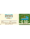
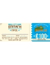
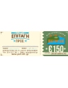
List of products by brand Anavasi
6.50 €
The new hiking map of Mt Penteli (or Pendeli) by Anavasi Editions at a scale of 1:16 000 invites you to discover one of the mountains that delimit the Athens plain through hiking and cycling trails. Old quarries, caves and monuments, including the famous "lithagogias road" from where the Parthenon marbles were transported to the Acropolis are recorded on...
5.00 €
Hiking map for Monemvasia in a scale of 1:50.000. The map covers the easternmost peninsula of the Peloponnese, a region with hilly terrain, many monuments and great natural beauty. Highlights of the area are the fortified city of Monemvasia and the exotic beaches of Elafonisos. Two networks of footpaths, the southern one around Neapoli and the northern...
6.50 €
Hiking map of Paxoi and Antipaxoi islands in a scale of 1:17.000.
9.50 €
Road Map of Thrace and North Aegean at scale 1:230.000.
9.50 €
Prespa is a region where landscapes of unique beauty and exceptional biodiversity coexist with notable Byzantine monuments and traditional villages. Prespa hosts the world’s largest breeding colony of Dalmatian Pelican and another 260 species of birds. Short and long hikes figuring on the map will take you to the most enchanting places.
9.50 €
The hiking map of Gramos, Smolikas, Voio, Vasilitsa in scale 1:40 000. The highest peak is Tsuka Petsik with an altitude of 2520m. Gramos is the fourth highest mountain in Greece after Olympus, Smolikas and Voras. This map covers the region north of the Zagori up to the Albanian border. A mountainous landscape of alternating peaks and ridges. The large...
9.50 €
1:110000 Road & Touring Map of Evia. Evia is the second largest island in Greece after Crete. In recent years, it has become a popular destination offering a wealth of natural landscapes and routes. The waterfalls of Drymona, the gorge of Dimosaris and Archampolis are between some of the most beautiful places in Greece, While Mt. Dirfys, the highest...
9.50 €
Hiking map for the area of Nafpaktos and Panaitoliko, Karpenisi and south Evritania in scale 1:50 000. The mountains of Evritania: Velouchi, Chelidona, Kaliakouda and Panetoliko on one side, and on the other the mountainous Nafpaktia area, where Anninos, Tsekoura, Ardini and Tsakalaki . On the proposed routes you will find climbs to the tops and...
9.50 €
The Mainalo - Artemisio Hiking map is now available. In scale of 1:40 000 and with extra map of the lesser known mountains of Artemisio and Farmakas on the back of the map. The Menalon Trail route is separated in daily segments with detailed description.
7.90 €
Hiking map of Mani in scale 1:30 000, a wild and sparsely inhabited region. Past the fertile zones of Gythio and Itilo, the map will guide you to the arid part of the peninsula known as "Mesa Mani" and as far as Cape Matapan or Tainaro (famous for the naval battle of Matapa in March 1941).
6.50 €
0Hiking map of Milos, Kimolos & Polyaigos islands in a scale of 1:32.000.
9.50 €
Hiking map for Giona - Vardousia in a scale of 1:25.000. The map of Giona - Vardousia 1: 25.000 is not the new version of the map of Giona - Oiti - Vardousia but a completely new map that proposes for the first time exploration and adventure routes. Because more and more people are seeking adventure on the spurs and the peaks of Mts Vardousia and Giona.
7.00 €
Hiking map of Mykonos, Delos & Rheneia islands in a scale of 1:25.000. Mykonos (Mikonos) with the nearby islands of Delos (Dilos or Délos in French) and Rheneia (Rineia, Rinia or Rhénée in French) on a light, waterproof and tear-resistant, GPS compatible map at 1:25 000. The reverse side shows a large, very detailed plan of the archaeological remains...
9.50 €
Hiking map for Zagori, Valia Kalda and Metsovo in a scale of 1:40 000. Zagori - Metsovo - Valia Kalda 1:40 000 map comprises all recent outdoor activity in the area. More than 10 mountain professionals collaborated for its update. This map is really the necessary tool for anyone traveling in the area. It does not replace Zagori 1:50 000 which has trail...
7.50 €
Touring map of Cyclades and Argosaronic in a scale of 1:200 000. The map of Cyclades - Argosaronic covers the areas of Attica with the Argosaronic islands of Salamina, Aegina, Ydra and Poros and all the Cyclades islands, printed on 2 sides with overlap. A very useful map, especially for island-hoppers, with short text for each island presenting the main...
9.50 €
Road and touring map for Attica and Viotia in scale 1:100 000..
9.50 €
Hiking map for Lefka Ori , Sfakia , Pahnes in a scale of 1:25.000. The new map covers the whole mountain range of Lefka Ori from its northern foothills to the Libyan Sea (Sfakia). All the hiking routes that crisscross the mountain (including the E4 trail) are clearly marked on the 1:25.000 map. On the back side of the map there are short descriptions and...
8.50 €
Hiking map of Ida (Psiloritis) mountain in a scale of 1:30.000. Mt Psiloritis dominates the center of the island and the hearts of the Cretan people. It is an imposing, steep and rugged mountain, the place of upbringing of Zeus, of the Cretan wild goats and the unconquered Cretan soul. Trails climb from all sides to the highest peak where there is a stone...
9.50 €
The hiking map of Pilio - Mavrovouni in scale 1:45 000 covers the whole Pilion peninsula and Mt Mavrovouni a natural continuation of Mt Pelion to the north. Twenty highlighted hiking routes among dozens of recorded footpaths are proposed.The mountainous Pelion peninsula is gifted with abundant forests, waters, fruit trees, stone-paved trails, excellent...
6.00 €
Kalimnos (also written Kalymnos or Calymnos) is an island of the Dodecanese archipelago, and climbing destination of the Mediterranean with more 2000 climbing routes. Kalimnos hiking map is waterproof and tear-resistant. The map shows all hiking trails and rock climbing sites.
8.50 €
The new Anavasi map of Ikaria on a scale of 1:35.000 figures dozens of footpaths, the complete road network and all the beaches of the island, which is also well known for its summer feasts (panigiria) and the longevity of its inhabitants.
6.50 €
A new detailed hiking map for Lemnos in scale 1:60 000 by Anavasi editions with information on its monuments and beaches.
9.50 €
Ηiking map of Agrafa Mountains printed on polyart paper. Scale 1:50000.