Your cart
There are no more items in your cart
-
-
 Gift Card 25 Euro25.00 €
 Gift Card 50 euro50.00 €
 Gift Card 100 Euro100.00 €
 Gift Card 150 euro150.00 €
-
-
-
Gift Card 25 Euro25.00 €
Gift Card 50 euro50.00 €
Gift Card 100 Euro100.00 €
Gift Card 150 euro150.00 €
-
-
-

-

-
Gift Card 25 Euro25.00 €
Gift Card 50 euro50.00 €
Gift Card 100 Euro100.00 €
Gift Card 150 euro150.00 €
-
-
-
Gift Card 25 Euro25.00 €
Gift Card 50 euro50.00 €
Gift Card 100 Euro100.00 €
Gift Card 150 euro150.00 €
-
-
Gift Card 25 Euro25.00 €
Gift Card 50 euro50.00 €
Gift Card 100 Euro100.00 €
Gift Card 150 euro150.00 €
-
Gift Card 25 Euro25.00 €
Gift Card 50 euro50.00 €
Gift Card 100 Euro100.00 €
Gift Card 150 euro150.00 €
-


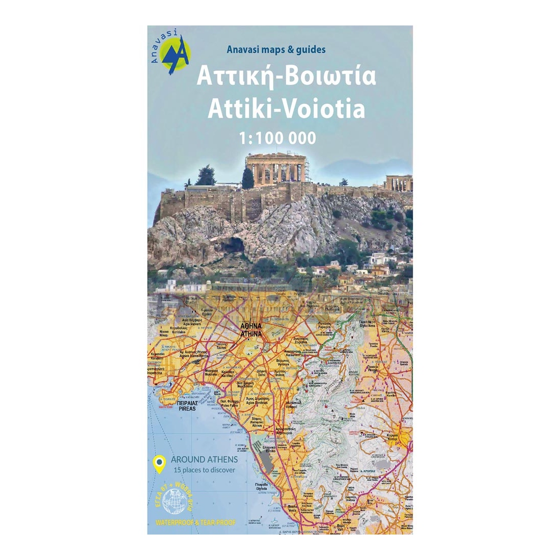
Description:
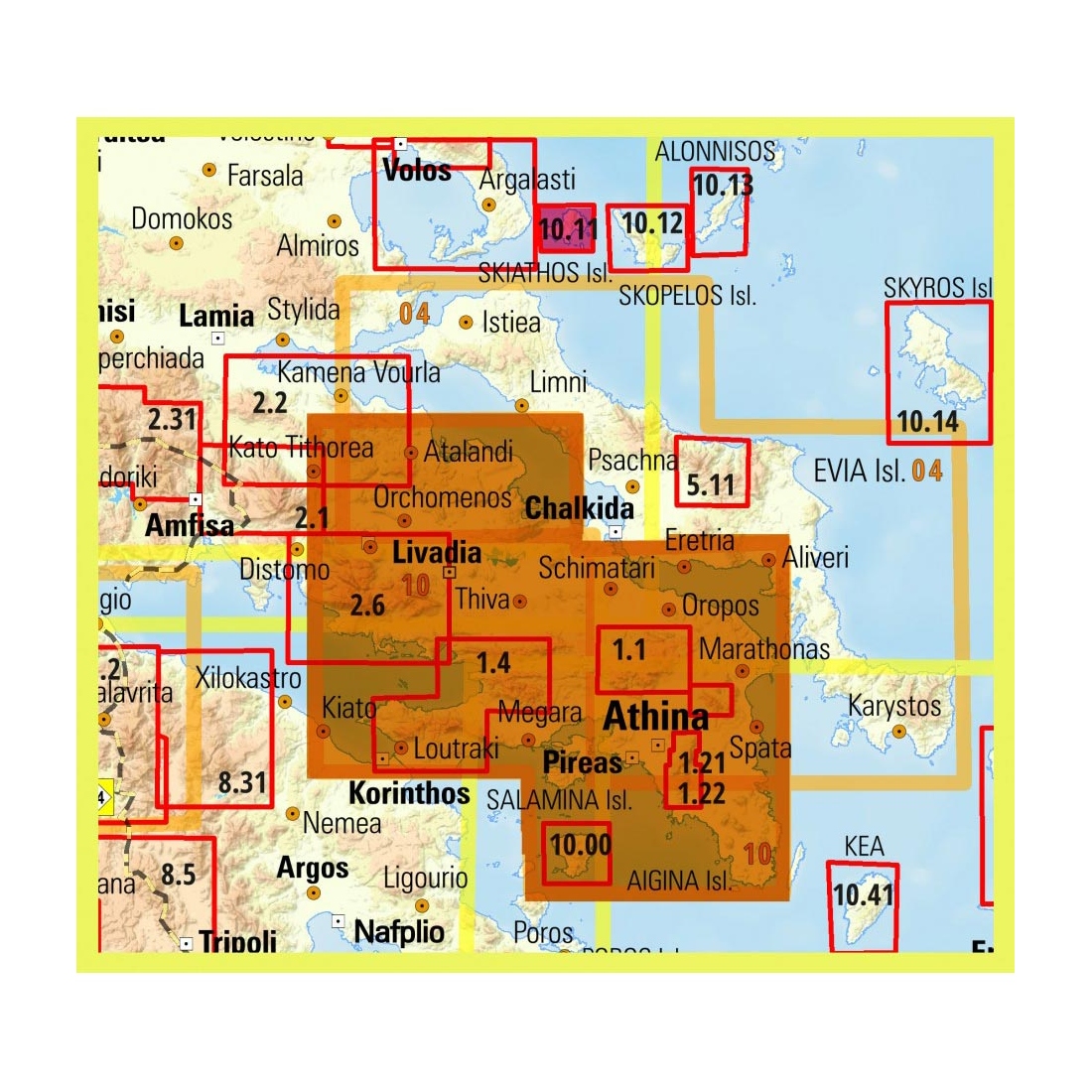
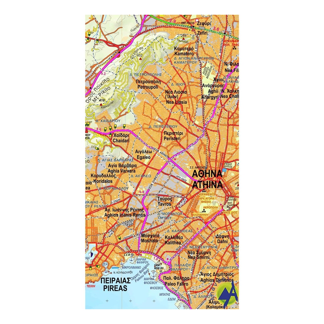
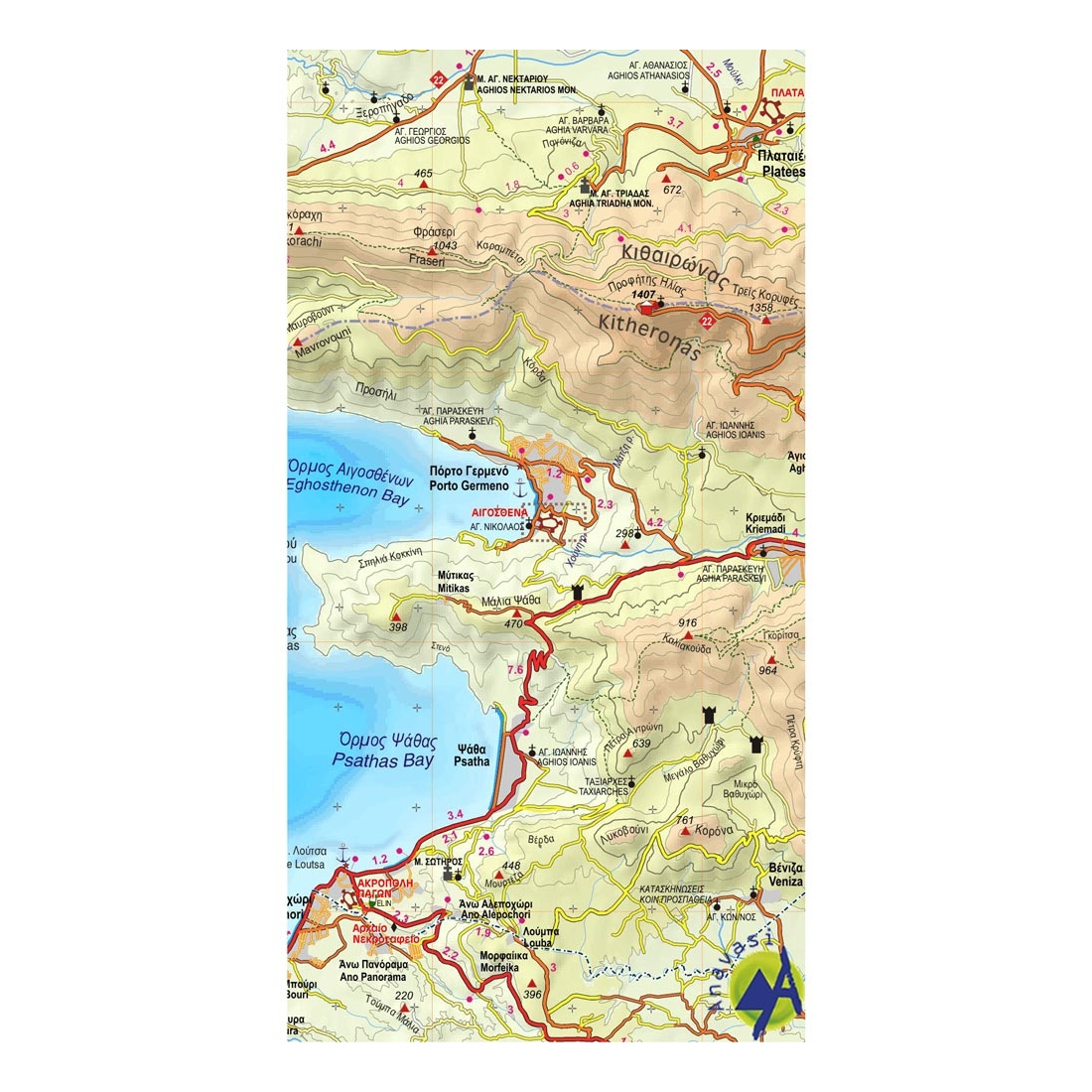
Attica is a historical region of Greece that has the largest population concentration around the country's capital, Athens. Plains delimited by mountains and a peninsula jutting into the surrounding seas: the Euboean, the Saronic and the Aegean. The map shows the intricate residential web and the boundaries of the Municipalities. The road network with names on the main roads and all the monuments (outside the urban fabric), monasteries and churches. The mountain massifs and protected areas, as well as suggetions for excursions. The western part of Attica, (Megaris, Mount Pateras and Kithaironas) is shown on the map of Viotia (Boeotia).
Viotia (Boeotia) has both large plains and large mountains as well as two lakes, Yliki and Paralimni. The map depicts accurately the residential and road network and a multitude of archaeological sites, including great sanctuaries, oracles, ancient fountains, castles and citadels most of them barely known. The main paths in the mountains and hills and the route of the national trail 22 that crosses Mt Elikon, Mt Zagaras and Mt Kitheron to end up via Mt Pastra in Parnitha are shown on the map.
On the back of the map there are 15 suggestions for excursions and walks in the countryside on the outskirts of the capital. Discover the countless monuments and mountains around Athens!
Printed on polyart paper.
Features:
- Waterproof, rip-stop Polyart paper
Specifications:
- Publication date: 2022
- Map reference code: 10
- Scale: 1:100.000
- ISBN: 978-960-9412-179

Tap to zoom