Your cart
There are no more items in your cart
-
-
 Gift Card 25 Euro25.00 €
 Gift Card 50 euro50.00 €
 Gift Card 100 Euro100.00 €
 Gift Card 150 euro150.00 €
-
-
-
Gift Card 25 Euro25.00 €
Gift Card 50 euro50.00 €
Gift Card 100 Euro100.00 €
Gift Card 150 euro150.00 €
-
-
-

-

-
Gift Card 25 Euro25.00 €
Gift Card 50 euro50.00 €
Gift Card 100 Euro100.00 €
Gift Card 150 euro150.00 €
-
-
-
Gift Card 25 Euro25.00 €
Gift Card 50 euro50.00 €
Gift Card 100 Euro100.00 €
Gift Card 150 euro150.00 €
-
-
Gift Card 25 Euro25.00 €
Gift Card 50 euro50.00 €
Gift Card 100 Euro100.00 €
Gift Card 150 euro150.00 €
-
Gift Card 25 Euro25.00 €
Gift Card 50 euro50.00 €
Gift Card 100 Euro100.00 €
Gift Card 150 euro150.00 €
-


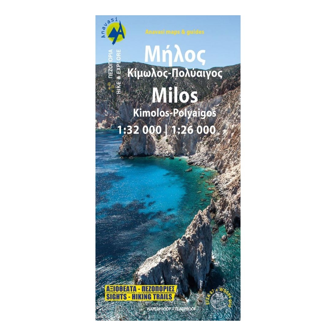
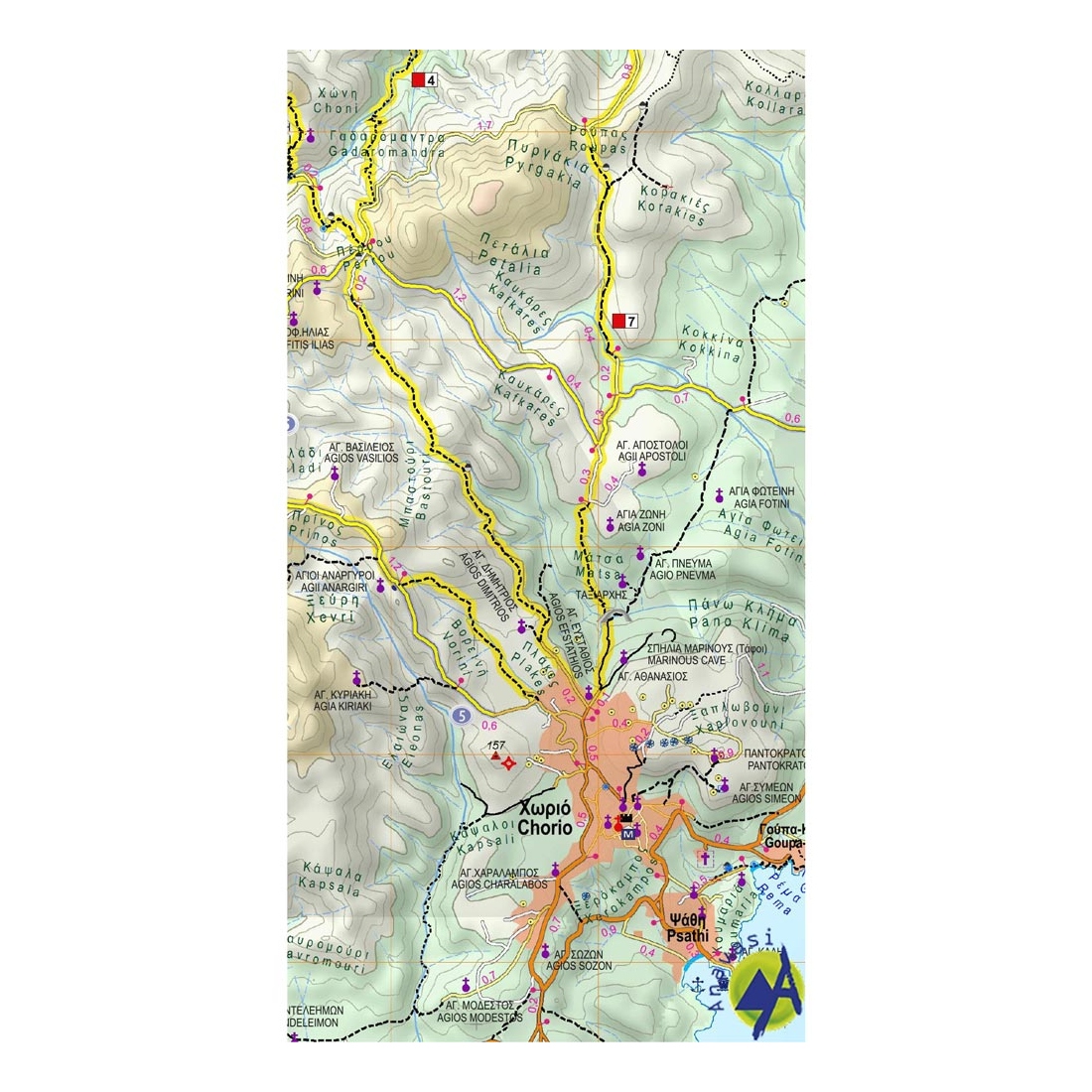
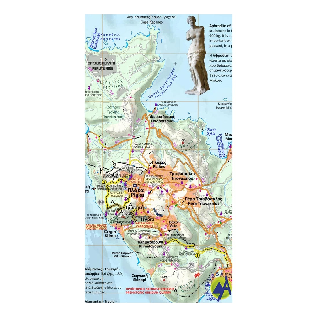
Milos - Kimolos - Polyaigos Hiking Map
0Hiking map of Milos, Kimolos & Polyaigos islands in a scale of 1:32.000.
Description:
Milos and the archipelago which also includes Kimolos, Polyvos, Erimomilos and smaller islets such as Akradies, Glaronisia etc. belong to the volcanic arc of the southern Aegean. These volcanic islands have an extremely interesting geological history and geology, that is reflected in their landscapes. Places like Paliohori, Sarakiniko,Papafragas, Kleftiko, Firiplaka, Paliorema or Vani with their unique landforms or colors reveal a story accessible only to the initiated
With this new map of Anavasi we propose to discover the marvelous beaches and unique monuments of Milos on one side and the beautifully conserved hinterland of Kimolos, with its lovely hiking trails, on the other.
The map includes significant information about the island, all the attractions, churches, villages and road network are appeared on the map.
A map in a handy size, printed on durable plastic paper as always.
Features:
- Waterproof, rip-stop plastic map
Specifications:
- Publication date: 2022
- Map reference code: 10.45
- Scale: 1:32.000 / 1:26.000
- ISBN: 9789609412407

Tap to zoom