Your cart
There are no more items in your cart
-
-
 Gift Card 25 Euro25.00 €
 Gift Card 50 euro50.00 €
 Gift Card 100 Euro100.00 €
 Gift Card 150 euro150.00 €
-
-
-
Gift Card 25 Euro25.00 €
Gift Card 50 euro50.00 €
Gift Card 100 Euro100.00 €
Gift Card 150 euro150.00 €
-
-
-

-

-
Gift Card 25 Euro25.00 €
Gift Card 50 euro50.00 €
Gift Card 100 Euro100.00 €
Gift Card 150 euro150.00 €
-
-
-
Gift Card 25 Euro25.00 €
Gift Card 50 euro50.00 €
Gift Card 100 Euro100.00 €
Gift Card 150 euro150.00 €
-
-
Gift Card 25 Euro25.00 €
Gift Card 50 euro50.00 €
Gift Card 100 Euro100.00 €
Gift Card 150 euro150.00 €
-
Gift Card 25 Euro25.00 €
Gift Card 50 euro50.00 €
Gift Card 100 Euro100.00 €
Gift Card 150 euro150.00 €
-


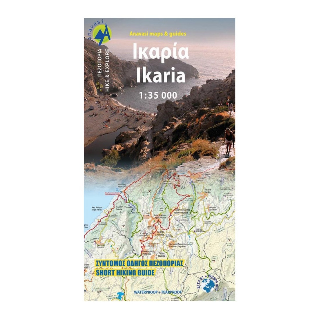
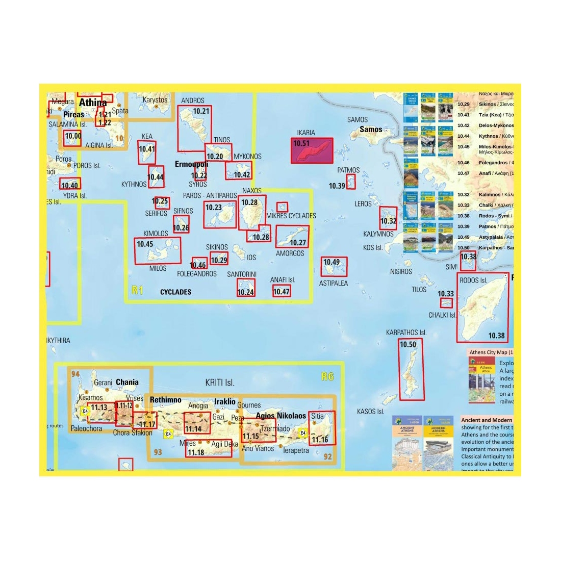
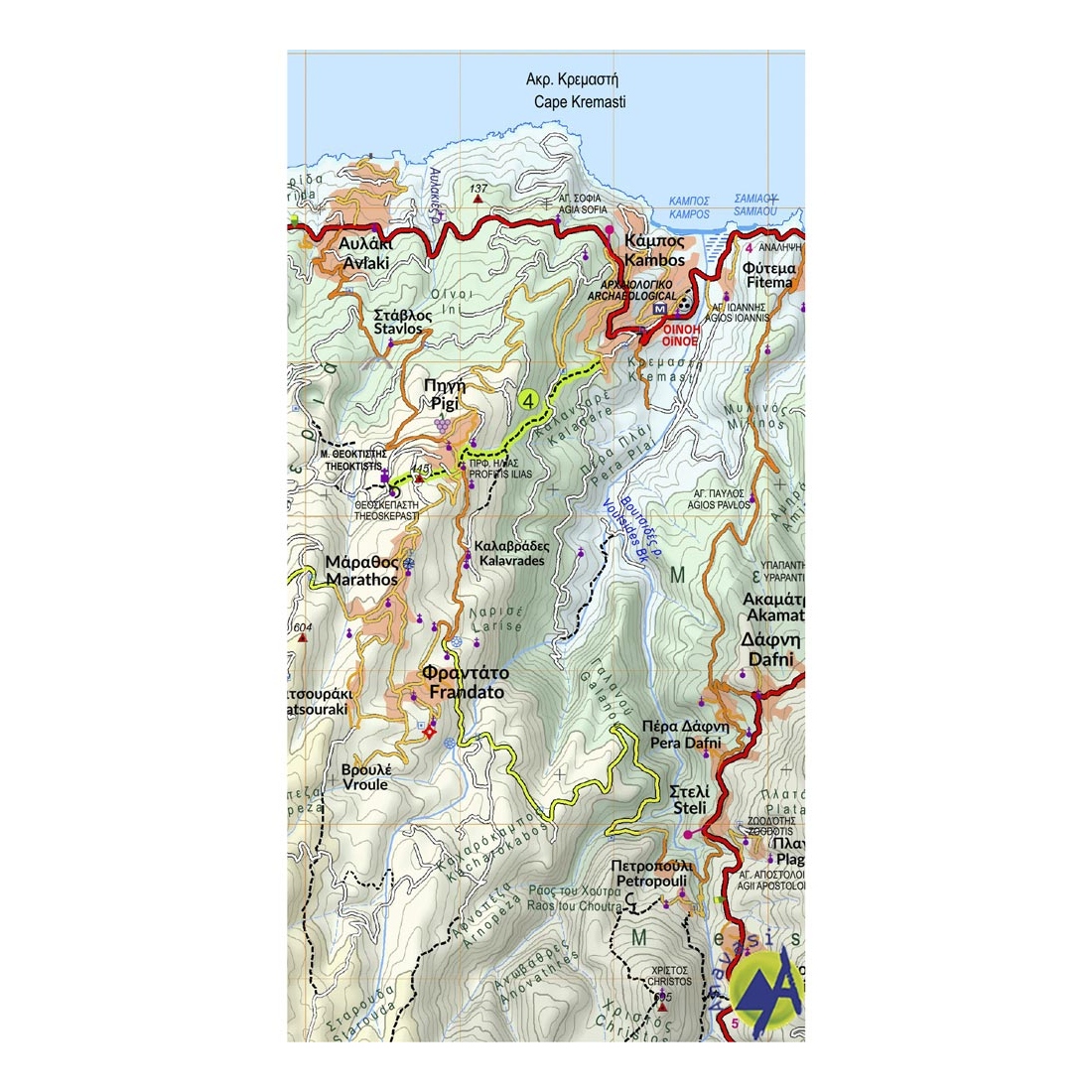
Ikaria Hiking Map
The new Anavasi map of Ikaria on a scale of 1:35.000 figures dozens of footpaths, the complete road network and all the beaches of the island, which is also well known for its summer feasts (panigiria) and the longevity of its inhabitants.
Description:
The island was named after the mythical Icarus, the young man who flew too close to the sun and plunged into the sea, close to Ikaria.
Ikaria has a well-marked network of hiking trails. The island is indeed perfect for days of hiking pleasure with lots of vegetation, deep river valleys with plenty of hidden, refreshingly cold (and clean) water pools, relatively level top plateaus and a ridge line that climbs up to about 900-1000m above sea level with amazing views and nice beaches to end the walks.
Features:
- Printing on waterproof, rip-proof polyart paper.
Specifications:
- Publication date: 2022
- Map reference code: 10.51
- Scale: 1:35.000
- ISBN: 9789609412575

Tap to zoom