Navigation & Weather

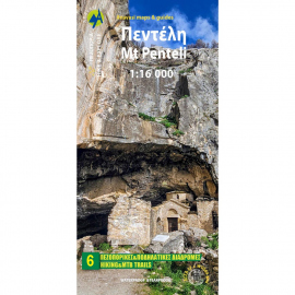
Maps Mt Penteli Hiking Map Maps Mt Penteli Hiking Map 2
In Stock
6.50 €
The new hiking map of Mt Penteli (or Pendeli) by Anavasi Editions at a scale of 1:16 000 invites you to discover one of the mountains that delimit the Athens plain through hiking and cycling trails. Old quarries, caves and monuments, including the famous "lithagogias road" from where the Parthenon marbles were transported to the Acropolis are recorded on...
Maps Monemvasia Hiking & Touring Map Maps Monemvasia Hiking & Touring Map 2
In Stock
5.00 €
Hiking map for Monemvasia in a scale of 1:50.000. The map covers the easternmost peninsula of the Peloponnese, a region with hilly terrain, many monuments and great natural beauty. Highlights of the area are the fortified city of Monemvasia and the exotic beaches of Elafonisos. Two networks of footpaths, the southern one around Neapoli and the northern...
Maps Prespa - Vitsi - Voras Hiking Map Maps Prespa - Vitsi - Voras Hiking Map 2
In Stock
9.50 €
Prespa is a region where landscapes of unique beauty and exceptional biodiversity coexist with notable Byzantine monuments and traditional villages. Prespa hosts the world’s largest breeding colony of Dalmatian Pelican and another 260 species of birds. Short and long hikes figuring on the map will take you to the most enchanting places.
Maps Gramos - Smolikas Hiking Map Maps Gramos - Smolikas Hiking Map 2
In Stock
9.50 €
The hiking map of Gramos, Smolikas, Voio, Vasilitsa in scale 1:40 000. The highest peak is Tsuka Petsik with an altitude of 2520m. Gramos is the fourth highest mountain in Greece after Olympus, Smolikas and Voras. This map covers the region north of the Zagori up to the Albanian border. A mountainous landscape of alternating peaks and ridges. The large...
Maps Evia Road & Touring Map Maps Evia Road & Touring Map 2
In Stock
9.50 €
1:110000 Road & Touring Map of Evia. Evia is the second largest island in Greece after Crete. In recent years, it has become a popular destination offering a wealth of natural landscapes and routes. The waterfalls of Drymona, the gorge of Dimosaris and Archampolis are between some of the most beautiful places in Greece, While Mt. Dirfys, the highest...
Maps Upland Nafpaktia - South Evritania Hiking Map Maps Upland Nafpaktia - South Evritania Hiking Map 2
In Stock
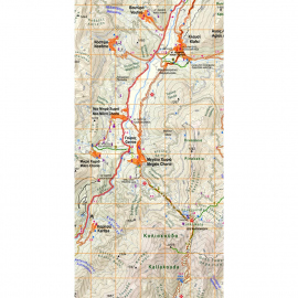
​Hiking map for the area of Nafpaktos and Panaitoliko, Karpenisi and south Evritania in scale 1:50 000. The mountains of Evritania: Velouchi, Chelidona, Kaliakouda and Panetoliko on one side, and on the other the mountainous Nafpaktia area, where Anninos, Tsekoura, Ardini and Tsakalaki . On the proposed routes you will find climbs to the tops and...
Maps Mainalo - Artemisio Hiking Map Maps Mainalo - Artemisio Hiking Map 2
In Stock
9.50 €
The Mainalo - Artemisio Hiking map is now available. In scale of 1:40 000 and with extra map of the lesser known mountains of Artemisio and Farmakas on the back of the map. The Menalon Trail route is separated in daily segments with detailed description.
Maps Mani Hiking Map Maps Mani Hiking Map 2
In Stock
Maps

Mani Hiking Map

AN8.4
7.90 €
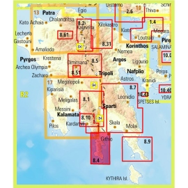
Hiking map of Mani in scale 1:30 000, a wild and sparsely inhabited region. Past the fertile zones of Gythio and Itilo, the map will guide you to the arid part of the peninsula known as "Mesa Mani" and as far as Cape Matapan or Tainaro (famous for the naval battle of Matapa in March 1941).
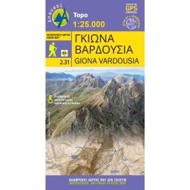
Maps Giona - Vardousia Hiking Map Maps Giona - Vardousia Hiking Map 2
In Stock
9.50 €
Hiking map for Giona - Vardousia in a scale of 1:25.000. The map of Giona - Vardousia 1: 25.000 is not the new version of the map of Giona - Oiti - Vardousia but a completely new map that proposes for the first time exploration and adventure routes. Because more and more people are seeking adventure on the spurs and the peaks of Mts Vardousia and Giona.
Product added to wishlist
Product added to compare.

We use cookies to improve user experience. Click Accept if you accept our cookies policy - privacy policy