Navigation & Weather

Maps Mt Penteli Hiking Map Maps Mt Penteli Hiking Map 2
In Stock
6.50 €
The new hiking map of Mt Penteli (or Pendeli) by Anavasi Editions at a scale of 1:16 000 invites you to discover one of the mountains that delimit the Athens plain through hiking and cycling trails. Old quarries, caves and monuments, including the famous "lithagogias road" from where the Parthenon marbles were transported to the Acropolis are recorded on...
Maps Monemvasia Hiking & Touring Map Maps Monemvasia Hiking & Touring Map 2
In Stock
5.00 €
Hiking map for Monemvasia in a scale of 1:50.000. The map covers the easternmost peninsula of the Peloponnese, a region with hilly terrain, many monuments and great natural beauty. Highlights of the area are the fortified city of Monemvasia and the exotic beaches of Elafonisos. Two networks of footpaths, the southern one around Neapoli and the northern...
Maps Prespa - Vitsi - Voras Hiking Map Maps Prespa - Vitsi - Voras Hiking Map 2
In Stock
9.50 €
Prespa is a region where landscapes of unique beauty and exceptional biodiversity coexist with notable Byzantine monuments and traditional villages. Prespa hosts the world’s largest breeding colony of Dalmatian Pelican and another 260 species of birds. Short and long hikes figuring on the map will take you to the most enchanting places.
Maps Gramos - Smolikas Hiking Map Maps Gramos - Smolikas Hiking Map 2
In Stock
9.50 €
The hiking map of Gramos, Smolikas, Voio, Vasilitsa in scale 1:40 000. The highest peak is Tsuka Petsik with an altitude of 2520m. Gramos is the fourth highest mountain in Greece after Olympus, Smolikas and Voras. This map covers the region north of the Zagori up to the Albanian border. A mountainous landscape of alternating peaks and ridges. The large...
Maps Evia Road & Touring Map Maps Evia Road & Touring Map 2
In Stock
9.50 €
1:110000 Road & Touring Map of Evia. Evia is the second largest island in Greece after Crete. In recent years, it has become a popular destination offering a wealth of natural landscapes and routes. The waterfalls of Drymona, the gorge of Dimosaris and Archampolis are between some of the most beautiful places in Greece, While Mt. Dirfys, the highest...
Maps Upland Nafpaktia - South Evritania Hiking Map Maps Upland Nafpaktia - South Evritania Hiking Map 2
In Stock
​Hiking map for the area of Nafpaktos and Panaitoliko, Karpenisi and south Evritania in scale 1:50 000. The mountains of Evritania: Velouchi, Chelidona, Kaliakouda and Panetoliko on one side, and on the other the mountainous Nafpaktia area, where Anninos, Tsekoura, Ardini and Tsakalaki . On the proposed routes you will find climbs to the tops and...
Maps Mainalo - Artemisio Hiking Map Maps Mainalo - Artemisio Hiking Map 2
In Stock
9.50 €
The Mainalo - Artemisio Hiking map is now available. In scale of 1:40 000 and with extra map of the lesser known mountains of Artemisio and Farmakas on the back of the map. The Menalon Trail route is separated in daily segments with detailed description.
Maps Mani Hiking Map Maps Mani Hiking Map 2
In Stock
Maps

Mani Hiking Map

AN8.4
7.90 €
Hiking map of Mani in scale 1:30 000, a wild and sparsely inhabited region. Past the fertile zones of Gythio and Itilo, the map will guide you to the arid part of the peninsula known as "Mesa Mani" and as far as Cape Matapan or Tainaro (famous for the naval battle of Matapa in March 1941).
Maps Giona - Vardousia Hiking Map Maps Giona - Vardousia Hiking Map 2
In Stock
9.50 €
Hiking map for Giona - Vardousia in a scale of 1:25.000. The map of Giona - Vardousia 1: 25.000 is not the new version of the map of Giona - Oiti - Vardousia but a completely new map that proposes for the first time exploration and adventure routes. Because more and more people are seeking adventure on the spurs and the peaks of Mts Vardousia and Giona.
Maps Delos - Mykonos - Rheneia Hiking Map Maps Delos - Mykonos - Rheneia Hiking Map 2
In Stock
7.00 €
Hiking map of Mykonos, Delos & Rheneia islands in a scale of 1:25.000. Mykonos (Mikonos) with the nearby islands of Delos (Dilos or Délos in French) and Rheneia (Rineia, Rinia or Rhénée in French) on a light, waterproof and tear-resistant, GPS compatible map at 1:25 000. The reverse side shows a large, very detailed plan of the archaeological remains...
Maps Zagori - Valia Kalda - Metsovo Hiking Map Maps Zagori - Valia Kalda - Metsovo Hiking Map 2
In Stock
Hiking map for Zagori, Valia Kalda and Metsovo in a scale of 1:40 000. Zagori - Metsovo - Valia Kalda 1:40 000 map comprises all recent outdoor activity in the area. More than 10 mountain professionals collaborated for its update. This map is really the necessary tool for anyone traveling in the area. It does not replace Zagori 1:50 000 which has trail...
Maps Cyclades - Argosaronic Road & Touring Map Maps Cyclades - Argosaronic Road & Touring Map 2
In Stock
Touring map of Cyclades and Argosaronic in a scale of 1:200 000. The map of Cyclades - Argosaronic covers the areas of Attica with the Argosaronic islands of Salamina, Aegina, Ydra and Poros and all the Cyclades islands, printed on 2 sides with overlap. A very useful map, especially for island-hoppers, with short text for each island presenting the main...
Maps Lefka Ori (White Mountains) - Sfakia/Pahnes Hiking Map Maps Lefka Ori (White Mountains) - Sfakia/Pahnes Hiking Map 2
In Stock
Hiking map for Lefka Ori , Sfakia , Pahnes in a scale of 1:25.000. The new map covers the whole mountain range of Lefka Ori from its northern foothills to the Libyan Sea (Sfakia). All the hiking routes that crisscross the mountain (including the E4 trail) are clearly marked on the 1:25.000 map. On the back side of the map there are short descriptions and...
Maps Psiloritis Hiking Map Maps Psiloritis Hiking Map 2
In Stock
Maps

Psiloritis Hiking Map

AN11.14
8.50 €
Hiking map of Ida (Psiloritis) mountain in a scale of 1:30.000. Mt Psiloritis dominates the center of the island and the hearts of the Cretan people. It is an imposing, steep and rugged mountain, the place of upbringing of Zeus, of the Cretan wild goats and the unconquered Cretan soul. Trails climb from all sides to the highest peak where there is a stone...
Maps Geopsis Agrafa Hiking Map Maps Geopsis Agrafa Hiking Map 2
In Stock
10.00 €
This two-sided map presents the the broader Agrafa area. At 1:50.000, it covers: North Agrafa, East Agrafa, West Agrafa, Argithea, Voulgara, Lake Plastira, Lake Kremaston, Lake Stefaniada, Achelous area, Agrafiotis, Megdovas, Rentina, Fourna, Amarantos etc.
Compasses & GPS Classic Pocket Compass Compasses & GPS Classic Pocket Compass 2
In Stock
Compasses & GPS

Classic Pocket Compass

RE562192
29.90 €
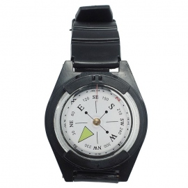
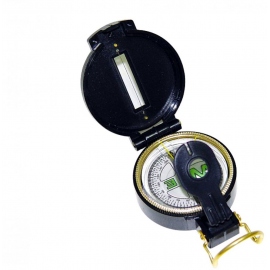
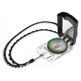
Solid brass pocket compass with an antique finish and leather case embossed with a compass rose. Equipped with a compass copper rose, side transport lock for the compass needle, pocket chain and a belt loop on the leather case. The top of the compass is also ideal for engraving a personal gift. A perfect companion for boy scouts, camping or hiking.
Compasses & GPS Desk Classic Compass Compasses & GPS Desk Classic Compass 2
In Stock
Compasses & GPS

Desk Classic Compass

RE562191
49.90 €
Elegant, maritime table compass in a nostalgic design. Gimbaled brass compass with 360° graduation in a beautiful wooden box. Handmade and robust, each piece is unique. A special gift idea for lovers of shipping, navigation or travel. The compass comes in a beautiful wooden box.
Maps Pelion Hiking Map Maps Pelion Hiking Map 2
In Stock
Maps

Pelion Hiking Map

AN4.3-4.4
9.50 €
The hiking map of Pilio - Mavrovouni in scale 1:45 000 covers the whole Pilion peninsula and Mt Mavrovouni a natural continuation of Mt Pelion to the north. Twenty highlighted hiking routes among dozens of recorded footpaths are proposed.The mountainous Pelion peninsula is gifted with abundant forests, waters, fruit trees, stone-paved trails, excellent...
Compasses & GPS Army Metal Compass
  • -5.00 €
In Stock
Compasses & GPS

Army Metal Compass

MT15789000
24.90 € 29.90 €
Army compass ultimate made of 100% metal.
Compasses & GPS Military Protractor
In Stock
Compasses & GPS

Military Protractor

CD032
29.90 €
This is a high quality accurate angle measuring device.  Issued to Combat military commanders to plot highly accurate 6 figure & 8 figure map coordinates and directions/bearings. Very useful tool for all levels of map reading and outdoor pursuits.
Maps Geopsis Ροδόπη Maps Geopsis Ροδόπη 2
In Stock
Maps

Geopsis Ροδόπη

GEO132
10.00 €
Waterproof, rip-proof hiking and touring map of Rodopi.
Binoculars - Telescopes Mountain View 8x32 Binoculars Binoculars - Telescopes Mountain View 8x32 Binoculars 2
  • -10.00 €
In Stock
Binoculars - Telescopes

Mountain View 8x32 Binoculars

RE480218
239.00 € 249.00 €
Powerful binoculars with a wide field of view and very good compact lenses. The multi-coated glass lenses are fog-free and reduce the reflection. The binoculars consists of a robust and waterproof housing. The large central drive allows easy and continuous focusing. In addition to a prescription, the binoculars with rotatable eyecups and long eye relief,...
Binoculars - Telescopes Tour View 12x32 Binoculars Binoculars - Telescopes Tour View 12x32 Binoculars 2
  • -5.00 €
In Stock
Binoculars - Telescopes

Tour View 12x32 Binoculars

RE480217
54.90 € 59.90 €
Lightweight and foldable binoculars. The fully coated optics, reduce the reflections. There provides a bright and clear image. The magnification makes this compact glass a good choice for travelers, hikers, sports events or wildlife viewing. The large central drive allows easy and continuous focusing. Equipped with diopter-compensation, belt pouch and...
Binoculars - Telescopes Konus Sight-Pro TR Red Dot Riflescope Binoculars - Telescopes Konus Sight-Pro TR Red Dot Riflescope 2
In Stock
Binoculars - Telescopes

Konus Sight-Pro TR Red Dot Riflescope

K7375
190.00 €
The SIGHT-PRO TR is among the most professional and technologically advanced units of its entire category. Instead of the traditional dot, it features 4 intechangeable reticles that have been chosen among the most versatile ones. Each of these reticles can be illuminated intwo selectable colors (red or green) and 5 different intensities. It also comes...
Maps Kalymnos Hiking Map Maps Kalymnos Hiking Map 2
In Stock
Maps

Kalymnos Hiking Map

AN10.32
6.00 €
Kalimnos (also written Kalymnos or Calymnos) is an island of the Dodecanese archipelago, and climbing destination of the Mediterranean with more 2000 climbing routes. Kalimnos hiking map is waterproof and tear-resistant. The map shows all hiking trails and rock climbing sites.
Binoculars - Telescopes Firefield Hexcore HD 1-3x Night Vision Binoculars Binoculars - Telescopes Firefield Hexcore HD 1-3x Night Vision Binoculars 2
In Stock
Binoculars - Telescopes

Firefield Hexcore HD 1-3x Night Vision Binoculars

FF18001
259.00 €
Experience the latest in nighttime exploration technology with the Hexcore HD 1-3x Digital Night Vision Binoculars. Equipped with a high-performance 1280x720 CMOS digital night vision sensor, these binoculars deliver exceptional clarity, allowing you to see the nocturnal world like never before. The 640x360 TFT LCD display enhances contrast, ensuring...
Maps Ikaria Hiking Map Maps Ikaria Hiking Map 2
In Stock
Maps

Ikaria Hiking Map

AN10.51
8.50 €
The new Anavasi map of Ikaria on a scale of 1:35.000 figures dozens of footpaths, the complete road network and all the beaches of the island, which is also well known for its summer feasts (panigiria) and the longevity of its inhabitants.
Maps Lemnos Hiking Map Maps Lemnos Hiking Map 2
In Stock
Maps

Lemnos Hiking Map

AN10.30
6.50 €
A new detailed hiking map for Lemnos in scale 1:60 000 by Anavasi editions with information on its monuments and beaches.
Binoculars - Telescopes Foldable Binoculars 10x25
  • -2.00 €
In Stock
Binoculars - Telescopes

Foldable Binoculars 10x25

AAN340080
12.90 € 14.90 €
10*25, high quality, compact design foldable binoculars ideal for professionals, hobbyists and nature lovers. In mini practical size, for easy transportation and storage. Clear lens to see every detail. Tire endurance enclosure and ergonomic design that provides good traction and stable grip, reducing the risk of slip and protecting from wear. 
Maps Mt. Athos Hiking Map
In Stock
9.90 €
A walking map to Mount Athos on the best available scale, 1:30 000 and reprinted in 2019.
Meteorological Stations Digital Anemometer Meteorological Stations Digital Anemometer 2
  • -10.00 €
In Stock
Meteorological Stations

Digital Anemometer

55418
19.00 € 29.00 €
Digital anemometer for industrail and home purposes. Ideal tool for windsurfing, sailing, fishing, kite flying and mountaineering.
Compasses & GPS Silva Expedition S Compass
In Stock
Compasses & GPS

Silva Expedition S Compass

SL37454
76.00 €
The Silva Expedition S is your preferred choice of you need a mirror sighting compass with many features. It is high performing when it comes to accuracy, precision and durability and is developed for experienced users and professionals.
Product added to wishlist
Product added to compare.

We use cookies to improve user experience. Click Accept if you accept our cookies policy - privacy policy