Your cart
There are no more items in your cart
-
-
 Gift Card 25 Euro25.00 €
 Gift Card 50 euro50.00 €
 Gift Card 100 Euro100.00 €
 Gift Card 150 euro150.00 €
-
-
-
Gift Card 25 Euro25.00 €
Gift Card 50 euro50.00 €
Gift Card 100 Euro100.00 €
Gift Card 150 euro150.00 €
-
-
-

-

-
Gift Card 25 Euro25.00 €
Gift Card 50 euro50.00 €
Gift Card 100 Euro100.00 €
Gift Card 150 euro150.00 €
-
-
-
Gift Card 25 Euro25.00 €
Gift Card 50 euro50.00 €
Gift Card 100 Euro100.00 €
Gift Card 150 euro150.00 €
-
-
Gift Card 25 Euro25.00 €
Gift Card 50 euro50.00 €
Gift Card 100 Euro100.00 €
Gift Card 150 euro150.00 €
-
Gift Card 25 Euro25.00 €
Gift Card 50 euro50.00 €
Gift Card 100 Euro100.00 €
Gift Card 150 euro150.00 €
-


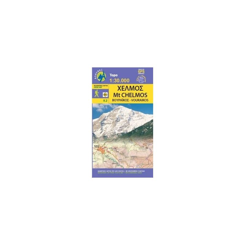
Mt. Chelmos - Vouraikos Hiking Map
Updated hiking map of Chelmos (or Helmos) in a scale of 1:30 000, the highest peak in Achaia (2355 m).
Description:
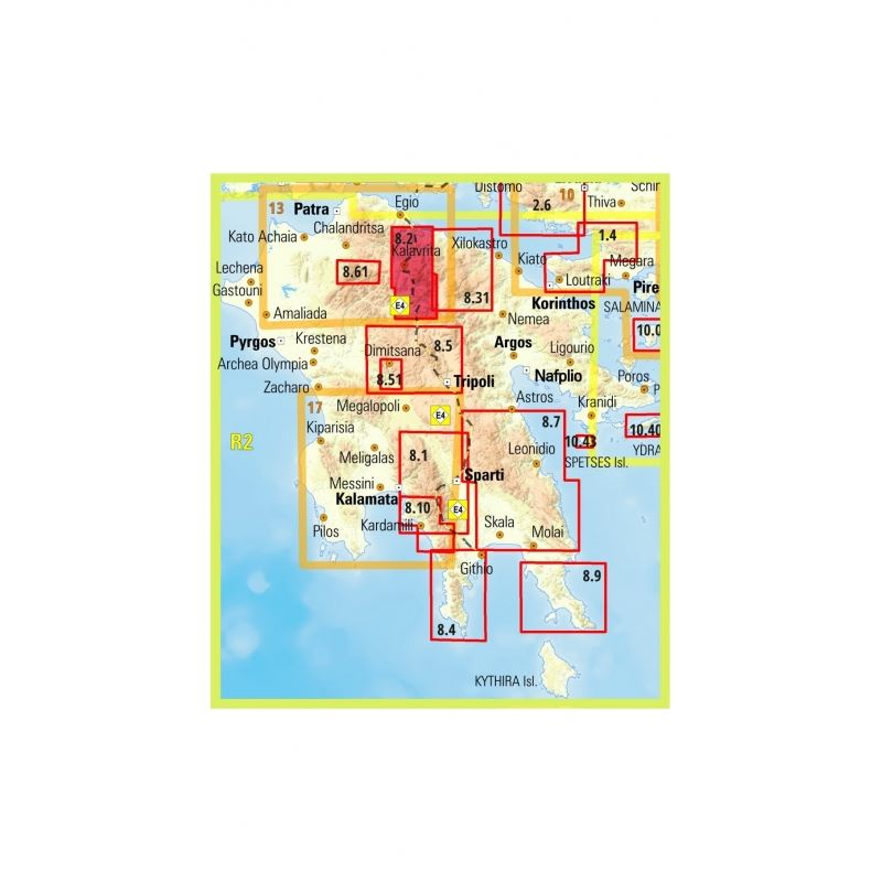
The map covers the area in Northern Peloponnese from Lake Tsivlos and from the forests of Zarouchla to the gorge of the Styx; from the source of the river Aroanios (Aroania being the ancient name of mount Chelmos), ancient Klitoria and the Cave of the Lakes to the remains of ancient Lousii; from the fertile farmlands of the Kerinitis valley to the panoramic view of Mt Klokos - all around the visitor unfolds a landscape rich in its beauty and its history.
The hiking maps of Anavasi editions cover selected mountain areas of central mainland Greece and the Peloponnese with GPS compatible, detailed topographic road maps at 1:30 000, printed on waterproof and tear-resistant paper. The plan of central Patras is conveniently placed on the detachable map cover.
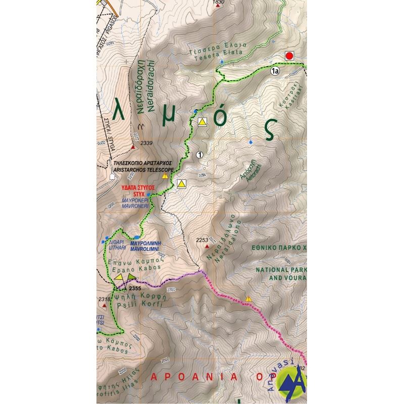
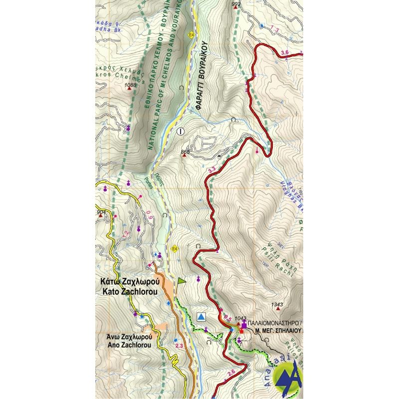
Contours at 20m intervals, relief shading and spot heights present the topography, and the map also show rivers, periodical streams and beaches. Road network includes minor unsurfaced roads, indicating those in poor condition. Intermediate distances are marked on main and secondary routes. Archaeological or historical sites and other places of interest are highlighted, with symbols marking mountain refuges, caves, thermal spas, etc. Names of town, villages, and most geographical features and places of interest are in both Greek and Latin alphabet. The maps have both GGRS87 grid lines and ticks plus crosshairs for latitude and longitude lines. Map legend includes English.
There are many trails on mount Chelmos, but the nicest path goes from Kalavrita to Diakopto, along the Vouraikos gorge. Start early at Diakopto, take the Odontotos, the funicular railway, to Kalavrita, and walk back to Diakopto.
The most impressive sight on mount Chelmos is the Styx waterfall, on Neraidoraxi's steep cliffs. In Greek mythology, Styx (or Stix) is the chtonian river that flows forth from the Underworld.
If you want to do something difficult try the South Ridge of Chelmos.
On mount Chelmos, don't miss the Cave of the Lakes (Spilaio ton Limnon), an impressive system of lakes inside a big cave.
Visit the mountain villages of Kalavrita, Planitero and Peristera.
In winter, try the ski resort near Kalavrita, where the ski-runs have mythological names.
| Map Info | |
| Map reference code | 8.2 |
| Publisher | Αnavasi |
| Scale | 1:30 000 |
| Edition | 2020 |

Tap to zoom