Your cart
There are no more items in your cart


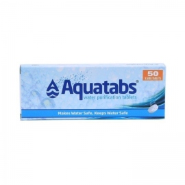
In Stock
7.45 €
Oasis Water Purification Tablets are effervescent Chlorine (NaDCC) tablets which purify water to make it safe to drink. They are highly effective in killing micro organisms in water to prevent dysentery, diarrhoea, cholera and other water borne diseases.


